
Vessel Tide | A Guide to Essential Maritime Data Analytics Systems » Marine Fleet Management Software and Related Software Comparison » Marine Fleet Management Software vs VMS: Key Differences Explained
Marine Fleet Management Software vs VMS: Key Differences Explained
Marine fleet management software and a Vessel Monitoring System (VMS) both track where a vessel is, which is why the two get lumped together in searches and RFPs. The similarity ends with position tracking. A VMS exists to report a vessel's position, course, and speed to a regulatory authority — such as a fisheries authority, flag state, or regional fisheries management organization — on a fixed schedule, usually because the law requires it. Marine fleet management software exists to run the vessel's operations for the company that owns or manages it: maintenance, crew, compliance, and voyage tracking, reported internally rather than to a regulator.
The two aren't substitutes for each other. Confirm which problem you're actually solving — a regulatory tracking obligation or day-to-day fleet operations — before assuming one system covers the other.
Key Takeaways
- VMS and marine fleet management software serve different audiences with different data: VMS reports position, course, and speed to a regulator; fleet management software manages maintenance, crew, compliance, and voyages for internal operational use.
- VMS is frequently a legal requirement, not a discretionary purchase — many jurisdictions mandate certified VMS terminals for fishing vessels above a specified gross tonnage, and some flag states extend similar tracking rules to other vessel classes.
- A fleet management platform's built-in position tracking is not automatically an accepted substitute for certified VMS reporting — check with the relevant fisheries authority or flag state before treating one as the other.
- Vessels subject to a VMS mandate typically need both systems: VMS for regulatory position reporting, and fleet management software for the maintenance, crew, and compliance operations VMS was never built to cover.
What is Marine Fleet Management Software?
Marine fleet management software runs a shipping company's day-to-day vessel operations from a single system: it schedules planned maintenance across every ship, manages crew rotations and certifications, files compliance reports against ISM Code, SOLAS, and flag-state requirements, and tracks voyage and port call data instead of leaving it scattered across separate tools.
The data this software produces stays largely internal — fleet managers, technical superintendents, and crewing teams use it to run the business of operating vessels. Position data is one input among many, feeding voyage dashboards and ETA calculations rather than serving as the platform's core purpose.
What is a Vessel Monitoring System (VMS)?
A Vessel Monitoring System (VMS) is a satellite-based tracking system that automatically reports a vessel's position, course, and speed to a monitoring authority at fixed intervals, typically every few minutes to a few hours. Onboard transceivers send this data over closed satellite networks — Inmarsat, Iridium, or Argos — to a monitoring center run by a fisheries authority, flag state, or regional fisheries management organization.
VMS underpins monitoring, control, and surveillance (MCS) programs used to monitor compliance with fishing-zone restrictions, exclusive economic zone (EEZ) boundaries, and catch reporting requirements, and to detect illegal, unreported, and unregulated (IUU) fishing. Many countries mandate VMS installation for fishing vessels above a set gross tonnage operating beyond a certain distance from shore; some extend similar tracking obligations to other regulated vessel classes.
VMS differs from AIS in a specific way: AIS broadcasts openly over VHF for collision avoidance and is visible to any receiver in range, while VMS transmits over a closed satellite channel restricted to the regulator that requires it.
Key Differences
A VMS answers one question for an external regulator: where is this vessel, and is it operating within the permitted area? Marine fleet management software answers a much broader set of questions for the company running the vessel.
| Dimension | Marine Fleet Management Software | Vessel Monitoring System (VMS) |
|---|---|---|
| Primary purpose | Run vessel operations: maintenance, crew, compliance, voyage | Report vessel position, course, and speed to a regulator |
| Data scope | Broad: maintenance records, crew certificates, compliance filings, voyage data | Narrow: position, course, speed, timestamp |
| Who receives the data | Internal: fleet managers, technical superintendents, crewing teams | External: fisheries authority, flag state, regional fisheries management organization |
| Adoption basis | Chosen as an operational tool | Often legally mandated for specific vessel classes and tonnages |
| Communication method | Varies by platform: ERP integration, ship-to-shore sync | Closed satellite network (Inmarsat, Iridium, Argos) to a monitoring center |
| Typical vessel type | Any commercial vessel: tankers, bulkers, container ships, offshore support | Historically fishing vessels; increasingly other regulated fleets |
A fleet management platform can display GPS position on a dashboard, but that display isn't the same as a certified VMS terminal transmitting to a government monitoring center on a fixed, tamper-resistant schedule — regulators generally don't accept one as a substitute for the other without explicit approval.
Overlapping Features
The overlap is limited to the raw ingredient both systems use: GPS and satellite positioning data. Fleet management software plots that position on voyage and ETA dashboards for operational use; a VMS transmits the same type of data, on a stricter schedule and through a closed channel, specifically so a regulator can verify it. Some fleet management platforms also ingest a vessel's VMS or AIS feed to display it alongside maintenance and compliance data, but that integration is a data feed into the platform, not a replacement for the certified VMS transmission itself.
Which One Do You Need?
Confirm first whether your vessels fall under a VMS mandate — check with the relevant fisheries authority or flag state whether your vessel class and tonnage require certified VMS installation, since this isn't optional once it applies.
If your vessels are subject to that mandate, you need certified VMS hardware and reporting regardless of what other software you run — no fleet management platform's built-in tracking can substitute for it without the regulator's explicit sign-off.
If your goal is running maintenance, crew, compliance, and voyage operations across the fleet, that's the job marine fleet management software is built for — a VMS terminal reporting to a regulator won't manage any of that.
Most operators subject to a VMS mandate end up running both, connected where possible: VMS handles the regulatory position reporting, while fleet management software handles everything else and, in some cases, ingests the VMS or AIS feed for its own operational dashboards.
Conclusion
These two systems solve different problems even though both start with a GPS coordinate. A VMS exists to prove a vessel's position to a regulator on a fixed, often legally mandated schedule. Marine fleet management software exists to run that vessel's maintenance, crew, compliance, and voyage operations for the company operating it. Before assuming either one covers the other, confirm your VMS obligations with the relevant fisheries authority or flag state, and check whether your fleet management platform can ingest that data rather than duplicate or replace it.
[Advertisement]
3 Recommended
Marine Fleet Management Software
3 Recommended
Marine Fleet Management Software
Advertiser Disclosure:
We receive compensation from some of the companies listed below.This compensation may affect which companies are included and the order in which they appear.
For Frequent Hazardous
or Long-Distance
Voyages
For Marine Fleet
Management Companies
or Long-Distance
Voyages
For Marine Fleet
Management Companies
MaSSA-One

* Image source: BEMAC Official
Website
(https://www.massa-one.com/english/)
(https://www.massa-one.com/english/)
Core Capabilities
Condition monitoring and anomaly detection
- Enables early detection of anomalies using data-driven automatic thresholds and expert-defined multi-condition detection.
- In the event of a failure, real-time data helps speed up root-cause identification, reducing downtime.
- This supports the prevention of future accidents and issues, contributing to reduced damage and losses involving vessels and cargo.
For Companies with
Frequent Business
in the EU
For Marine Shipping
Companies
Frequent Business
in the EU
For Marine Shipping
Companies
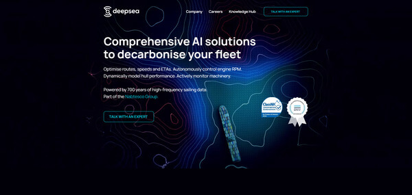
DeepSea
* Image source: DeepSea Official
Website
(https://www.deepsea.ai/)
(https://www.deepsea.ai/)
Core Capabilities
AI Fuel, CII &
Route Optimization
Route Optimization
- With the CII tracking feature, AI helps maintain and predict vessel performance.
- AI dynamically evaluates speeds and routes to suggest more fuel-efficient alternatives
- While complying with Europe-specific restrictions and regulations, it supports operations aimed at lower fuel consumption.
For Fleets with a Mix
of Older and Newly
Built Vessels
For Independent Ship
Management Companies
of Older and Newly
Built Vessels
For Independent Ship
Management Companies
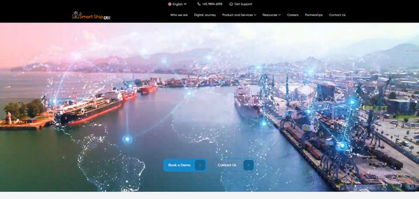
Smart Ship Hub
* Image source: Smart Ship Hub Official
Website
(https://smartshiphub.com/)
(https://smartshiphub.com/)
Core Capabilities
Data integration across a mixed fleet
- Supports aggregation of vessel data across different manufacturers and standards, as well as data from multiple vessels.
- Visualizes information distributed across onboard systems and supports building an environment for centralized management.
- Supports information sharing between shore teams and fleets with older vessels, older equipment, newly built vessels and new equipment.